- Mountains and deserts: an influential geographical factor
- The United States: A weapon designed to strike distant and fortified targets
- GBU-57 bunker buster
- Fordow: A model of the intersection of geography and fortification
- Distance: A challenge for aviation, and the American advantage in return.
- The sea… another factor in the equation
- Why is it difficult to translate air superiority into complete control?
- Geography does not prevent a strike, but it does influence its outcome.
- Iran and the United States: A different equation of power
- Hormuz: The meeting point of geography and the global economy
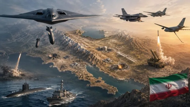
Washington, DC – Iran’s geography presents unique challenges for any military force seeking to conduct large-scale operations within the country. At the same time, the United States possesses long-range air and missile capabilities designed to engage deeply fortified targets. This equation is clearly reflected in the nature of Iran’s military and nuclear facilities. It is also evident in the vastness and diverse terrain of Iran, contrasted with Washington’s ability to conduct precision strikes from a distance.
Iran lies between the Persian Gulf and the Caspian Sea. Its territory extends across a vast plateau surrounded by major mountain ranges, most notably the Zagros Mountains in the west and southwest and the Alborz Mountains in the north. The Alborz Mountains, in particular, separate the Caspian Sea coast from the Iranian interior. They form a broad mountain range with limited passes. This topography gives Iran considerable geographical depth, as the country is not concentrated in a narrow coastal strip. Furthermore, the distances between the western, southern, and western regions and the major inland centers pose logistical challenges to any extended military operation.
Mountains and deserts: an influential geographical factor
The Zagros Mountains are a major geographical feature in western Iran, while the Alborz Mountains extend to the north. The presence of these mountain ranges divides large swathes of Iranian territory into regions with varying topography. This makes large-scale ground operations more complex compared to countries with more open terrain. This geographical nature does not mean that Iran is immune to air strikes, but it does increase the importance of the distribution, depth, and fortification of military and strategic installations. This becomes particularly critical when targets are buried underground or protected by strong fortifications. Destroying such targets then becomes more dependent on the type of munitions used and the means of reconnaissance and target identification.
The United States: A weapon designed to strike distant and fortified targets
In contrast, the United States possesses a range of air and missile systems that grant it a significant capacity for long-range operations. The B-2 Spirit bomber stands out as one of the most important of these systems. According to the US Air Force, the aircraft possesses stealth characteristics that reduce the likelihood of its detection and tracking by air defense systems, and its range without refueling is approximately 9,600 kilometers. It can also carry conventional and nuclear weapons. The B-2’s importance in warfare against heavily fortified targets lies in its ability to combine long range, stealth technology, and a large payload of ordnance. For this reason, it is well-suited for operations requiring access to heavily fortified targets.
GBU-57 bunker buster
The Massive Ordnance Penetrator, or GBU-57, is one of the most important American weapons designed to target heavily fortified facilities. The U.S. Air Force states that the weapon is designed to reach protected, deep underground facilities, particularly those associated with weapons of mass destruction. Its development and testing began in the first decade of this century before the program was transferred to the Air Force. The weapon’s significance became even more apparent in June 2025 when the U.S. Department of Defense announced the use of B-2 bombers to drop 14 GBU-57 bombs on targets in Iran, including facilities at Fordow, Natanz, and Isfahan. The Department later stated that the U.S. assessed the strikes had inflicted significant damage on the targeted facilities. This operation demonstrates that geography and fortifications are no longer necessarily insurmountable obstacles. However, the choice of weapon and the type of operation become even more critical factors.
Fordow: A model of the intersection of geography and fortification
Iran’s Fordow facility stands out as one of the most striking examples of the relationship between geography and fortified military installations. Located in a mountainous environment, with parts of it underground, the facility presents a different challenge than those situated on the surface. From a military perspective, its underground location does not preclude it from being targeted. However, it does increase the requirements for a strike and makes assessing the extent of damage to the facility significantly more difficult than assessing damage to a surface installation.
Distance: A challenge for aviation, and the American advantage in return.
Iran’s vast size imposes another challenge on air operations: long distances. However, the United States possesses means to mitigate this challenge, primarily long-range aircraft and aerial refueling. US Air Force data indicates that the B-2 has a range of approximately 6,000 nautical miles without refueling. This enables it to conduct operations far from its home bases. Thus, Iran’s expansive territory presents a challenge to the continuity and frequency of operations. Nevertheless, it does not preclude the United States from reaching distant targets within Iranian territory.
The sea… another factor in the equation
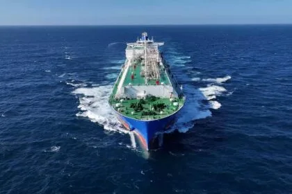
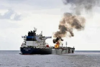
Iran’s geography extends far beyond its landmass; it boasts a long coastline along the Persian Gulf and the Gulf of Oman. It also overlooks one of the world’s most vital maritime chokepoints, the Strait of Hormuz. Connecting the Persian Gulf to the Gulf of Oman and the Arabian Sea, the strait is described by the U.S. Energy Information Administration (EIA) as one of the world’s most critical oil transit chokepoints. Average oil flows through the strait during the first half of 2025 reached approximately 20.9 million barrels per day, representing roughly 20% of global oil consumption, according to the EIA. This geography means that any military confrontation between Washington and Tehran would have repercussions far beyond the military sphere. In fact, it could extend to trade, energy, oil markets, and maritime transport.
Why is it difficult to translate air superiority into complete control?
The United States possesses a clear advantage in certain elements of air power, reconnaissance, and long-range strikes, but this differs from the ability to control a large and geographically expansive country. Air strikes can target facilities, command centers, bases, and infrastructure. On the other hand, controlling the ground requires massive forces, logistical capabilities, and a prolonged operational period. Iran’s geography makes any large-scale ground operation significantly more complex, especially given its vast mountainous and desert regions and the dispersal of population centers, economic hubs, and military installations. Therefore, the nature of American weaponry is better suited to long-range strikes and the destruction of high-value targets. In contrast, comprehensive ground operations present an entirely different challenge.
Geography does not prevent a strike, but it does influence its outcome.
Military experience demonstrates that mountains and vast expanses do not offer absolute protection against modern weapons. While American technology can reduce the effect of distance, stealth aircraft can operate in complex defensive environments, and bunker-buster weapons are specifically designed to engage buried targets, technology cannot negate the fact that Iran is a vast and geographically diverse country. Furthermore, destroying a number of facilities does not necessarily eliminate all of the country’s military, industrial, or missile capabilities. Therefore, the distribution of facilities and capabilities, and the ability to rebuild, become crucial factors in assessing the results of any air campaign.
Iran and the United States: A different equation of power
A comparison between the two sides reveals that each possesses distinct strengths. The United States relies on its superiority in air technology, long-range capabilities, reconnaissance, precision munitions, stealth aircraft, and the ability to conduct operations from outside Iranian territory. Iran, on the other hand, benefits from its vast territory, mountainous terrain, geographic depth, strategic maritime location, and the ability to disperse its military and industrial capabilities widely. This does not imply a military balance between the two sides; the disparity in air, technological, and logistical capabilities is significant. Nevertheless, geography makes the extent of American superiority less likely to result in a swift and decisive victory.
Hormuz: The meeting point of geography and the global economy
Iran’s proximity to the Strait of Hormuz adds to its strategic importance. Data from the U.S. Energy Information Administration indicates limited alternatives for transporting the oil volumes passing through the strait, despite the existence of pipelines in Saudi Arabia, the UAE, and Iran that could bypass some of the flow. Therefore, any prolonged disruption in the strait could escalate from a regional military issue into a crisis in energy markets and maritime transport, making Iran’s geographical position a factor with implications far beyond the battlefield.