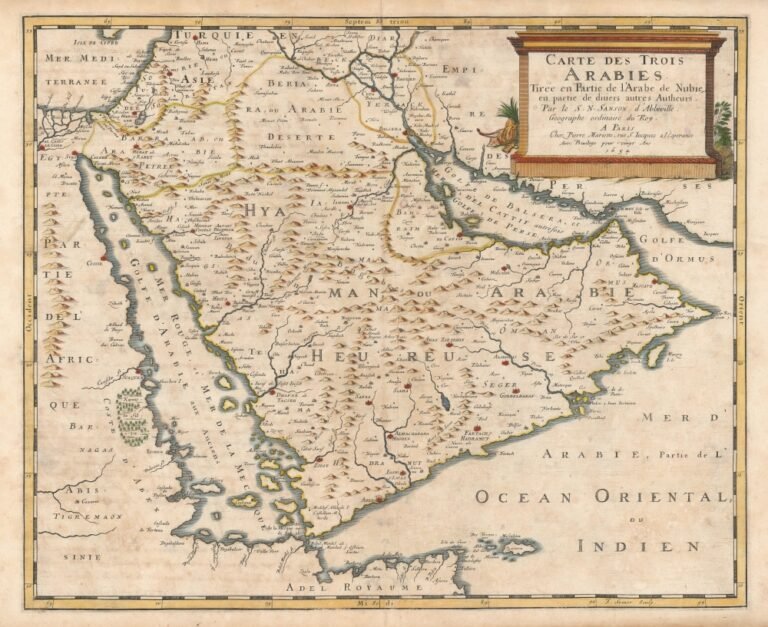
Mecca – Saudi Arabia — Ancient maps of Holy Mecca stand as some of the most critical and prominent historical documents. They reveal how travelers, geographers, and painters perceived the Sacred City throughout the eras. These cartographic manuscripts were never merely silent topographical tools for tracing routes and locations. Rather, they morphed into highly essential visual and cultural records. They documented the sublime spiritual status of Mecca and its profound emotional presence in the hearts of Muslims worldwide.
The Grand Mosque as the Core and Anchor
Since the dawn of early Islamic centuries, Mecca garnered exceptional and widespread attention from geographers and chroniclers. These experts raced to sketch its landmarks and precisely map the sacred ritual sites and the major highways leading to them. As the arts of drawing and cartography advanced, more intricate blueprints began to emerge. They seamlessly blended spatial precision with artistic vision. Thus, these maps mirrored the deep emotions and perceptions of their creators toward the holy site.
Numerous historical maps unveil a sharp visual and structural emphasis on the Grand Mosque (Al-Masjid al-Haram) and the Holy Kaaba as the beating heart and central axis of the urban fabric. These ancient illustrations positioned the Holy Kaaba directly at the mathematical center of the map. Meanwhile, residential quarters, traditional marketplaces, surrounding mountain ranges, and expansive pathways branching out toward the ritual sites of Mina, Arafat, and Muzdalifah radiated symmetrically around it.
The Role of Chroniclers and Evolution Through Time
Muslim travelers played a monumental role in projecting a living image of Mecca across the expansive Islamic world. Their manuscripts and travelogues housed meticulous descriptions of the city’s architectural and social atmospheres. In doing so, they helped millions of Muslims who had not yet undertaken the Hajj pilgrimage visualize the Qibla toward which they align their bodies during daily prayers. Throughout the Middle Ages, maps drafted by geographers across diverse civilizations emerged. Some relied on direct fieldwork. Meanwhile, others synthesized the oral accounts of pilgrims and merchants. This inevitably led to varying degrees of technical accuracy. Yet, all uniformly mirrored the extraordinary importance of Mecca in global human awareness.
With the boom of exploration expeditions and the rapid modernization of illustration and printing technologies during the 18th and 19th centuries, mapping techniques became significantly more detailed and realistic. This era clearly captured specific streets, ancient suqs, main administrative edifices, and the successive urban updates that reshaped Mecca. These changes accommodated the massive, growing influxes of pilgrims arriving from every corner of the globe.
A Historic Legacy Preserved in Global Museums
Specialized researchers in history and cartography argue that the value of these rare maps transcends mere geographical or spatial utility. They serve as an indispensable archival treasure for understanding the deep evolution of Islamic architecture, social dynamics, and economic life in Mecca across hundreds of years. Furthermore, they unveil how different global cultures envisioned the Hejaz region long before the dawn of modern photography.
Today, prominent global and Arab libraries and museums safeguard a massive collection of these rare, antique manuscripts and maps, celebrating them as an intangible asset of glorious human and Islamic heritage. They provide researchers and successive generations with a peerless window to explore the historic image of Holy Mecca as seen and crafted by human hands over the centuries. This happened long before its every detail was captured by modern camera lenses and digital satellite imaging systems.