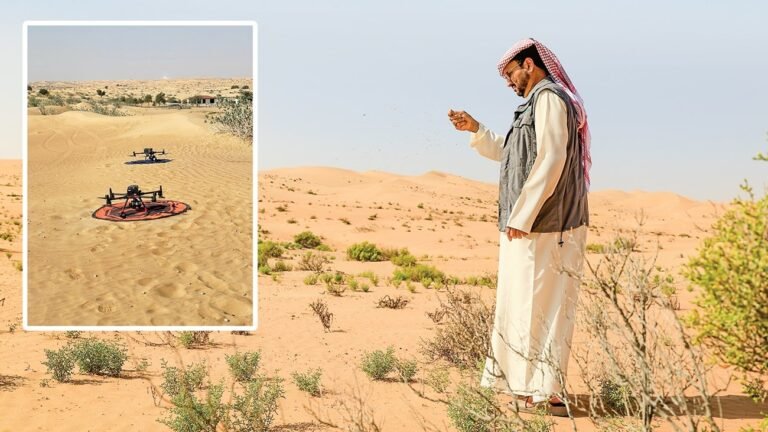
Abu Dhabi, UAE – Environment Agency – Abu Dhabi announced the expansion of the scope of the desert vegetation classification project to include new areas in the emirate during the current year. In a move that reflects its commitment to enhancing the sustainability of natural resources and developing environmental monitoring tools using the latest technologies.
The project relies on employing artificial intelligence technologies and drones (drones) to analyze and classify vegetation cover with high accuracy. By combining spectral signatures with advanced scientific indicators, it enables tracking changes in natural habitats and understanding the response of ecosystems to factors such as grazing and climate change. This methodology provides accurate data that contributes to supporting environmental planning and decision-making.
The Authority explained that the new expansion comes as a continuation of its efforts to monitor vegetation cover over a long period of time. To help assess the impacts of climate change and pressures resulting from human activities. Including overgrazing and vehicle use in wilderness areas, and their impacts on habitat sustainability.
advanced technologies
In a related context, this project is an extension of the Authority’s approach to employing advanced technologies in environmental work. A number of initiatives have previously been implemented that relied on artificial intelligence and drones in the fields of soil monitoring, monitoring environmental changes, and rehabilitating natural habitats. This contributed to building an accurate and comprehensive database on the components of the local environment, paved the way for the application of more advanced solutions in vegetation cover analysis and enhanced the efficiency of environmental monitoring operations.
environmental impact
The Authority confirmed that the adoption of modern technologies has contributed to significantly raising the efficiency of field work. It provided access to areas difficult to cover using traditional means, while reducing the environmental impact resulting from field surveys.
This approach also contributed to rationalizing operational and administrative costs by 90%, and significantly reducing the time required to complete studies compared to traditional methods.
Through artificial intelligence and drones, specialized teams at the Environment Agency – Abu Dhabi were able to cover large areas of wild habitats and collect and analyze accurate data on biomarkers of a number of local plants. This made it possible to assess the health of vegetation cover and identify the most prominent factors affecting it, whether natural or related to human activities.
In its previous phases, the project also included photographic documentation of wildlife distribution areas and an analysis of the relationship between these species and vegetation cover. This has contributed to deepening scientific understanding of the nature and dynamics of desert ecosystems.
intelligent platform
In support of digital transformation, the Authority has developed a smart platform for an integrated geographic database, enabling instant reporting and accurate analysis. To enhance the efficiency of environmental information management. Experiments were also carried out to scatter seeds of local plants using drones in a number of regions. With the aim of studying the natural regeneration rates of plants according to rainfall factors and soil quality, with annual follow-up to measure the success of germination processes.
The Authority stressed that this project represents a qualitative shift in environmental work methods and enhances its ability to protect biodiversity. And support data-driven efforts to conserve nature. In line with the emirate’s vision towards a sustainable environmental future.