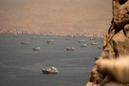
Tehran – Recent satellite imagery has detected a massive oil slick suspected to be a leak from military or technical operations near Kharg Island, Iran’s primary crude oil export hub. This news has sparked serious concerns regarding catastrophic environmental and economic repercussions in the Gulf waters, coinciding with ongoing military tensions. Analysts fear the spill resulted from targeted strikes or infrastructure failure during the conflict.
Space Monitoring Reveals 45-Square-Kilometer Slick
Reuters reported that satellite images from the European “Copernicus” program (Sentinel-1, 2, and 3) detected a vast gray and white slick west of the island between May 6 and May 8. According to initial analysis, the slick covers an estimated 45 square kilometers, making it one of the most significant environmental incidents recorded in the region recently.
Largest Leak in 70 Days of Conflict
Leon Moreland, a researcher at the Conflict and Environment Observatory, confirmed that the slick’s optical characteristics are consistent with crude oil. Meanwhile, Louis Goddard, co-founder of Data Desk, noted that this potential leak is the largest of its kind since the outbreak of hostilities approximately 70 days ago. This suggests that oil infrastructure may have been damaged by military operations or cyberattacks targeting export facilities.
Environmental Threats and International Silence
Despite the severity of the images, no official comments have been issued by the US military or the Iranian mission to the UN. Environmental experts warn that the continued flow of oil threatens regional “Biodiversity” and could lead to long-term contamination of fisheries and desalination plants. This adds a tragic environmental dimension to the ongoing conflict, placing an urgent responsibility on the international community to contain the disaster.