- The first sign… a hotspot appearing near the population.
- The second sign… the Earth becomes increasingly difficult to reach.
- The third sign: Water is shifting from a service into a point of pressure.
- Samia’s Eye… When Life Itself Became Unsustainable
- Ras El Tin… When Departure Becomes a Cumulative Result
- The fourth sign… the road becomes part of the crisis.
- The fifth sign: Fear transforms into an economic decision.
- Qusra… Are the same stages repeating?
- Fasayil… When Water Becomes Part of the Battle for the Land
- From the Focal Point to the System
- What happens when the residents leave?
- Is it possible to construct a “depletion risk index”?
- From “Forced Displacement” to “Manufacturing the Conditions for Departure”
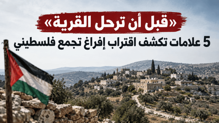
Abu Dhabi, UAE – In the West Bank, Palestinian displacement does not necessarily begin the moment residents leave their homes. In many pastoral and rural communities, departure is preceded by a long period of mounting pressures: a settlement outpost appears nearby, restricting space for movement and grazing; water sources are damaged; access routes become increasingly difficult; and repeated attacks and harassment occur until remaining in the area becomes an unbearable burden.
This is not a rule that automatically applies to every Palestinian community, but rather a hypothesis that can be tested against documented cases. UN data reveals that 45 Palestinian communities have been completely emptied since January 2023 due to settler attacks and access restrictions, while dozens of other communities have experienced partial displacement. By 2026, settler violence and associated restrictions had become one of the primary drivers of displacement in the West Bank.
The first sign… a hotspot appearing near the population.
In a number of cases documented by the United Nations, the establishment of an outpost was not an event isolated from the subsequent deterioration in the residents’ lives. In the Hebron-area villages of Al-Buweira and Hiwara, UN assessments linked the emergence of settlement outposts near the two communities to an increase in attacks and restrictions on access to agricultural land and grazing areas, as well as—in some instances—the closure of the only access roads.
In Hiwara, an outpost was established near the settlement in 2024, while another appeared near Al-Buwayra in 2025. Subsequently, the number of documented attacks rose, accompanied by damage to homes and sources of income, as well as reduced access to land. Here, a key indicator emerges: the presence of a new outpost does not mean displacement is inevitable, but it becomes a factor that warrants monitoring developments in the surrounding area.
The second sign… the Earth becomes increasingly difficult to reach.
For communities reliant on herding and agriculture, land need not be formally confiscated to become unusable. It suffices for grazing areas to shrink, access routes to be blocked, farmers and herders to face repeated harassment, or access to the land to become perilous for the economic activity sustaining the local population to begin to contract. In Bouira and Hiwara, UN assessments reported that residents faced increasing restrictions on accessing agricultural land and grazing zones, alongside the obstruction of access routes. The assessments also documented recurring damage to crops, property, and livelihoods. Here, the question shifts from “Has the land been confiscated?” to a more precise inquiry: “Are the owners still able to use it?”
The third sign: Water is shifting from a service into a point of pressure.
Water is the most critical resource for pastoralist communities. In June 2026, the United Nations reported that settlers had seized control of the sole water sources serving the Bedouin communities of Dar Faza’ and East Taybeh, completely cutting off the water supply for more than 200 people. In July, the UN documented further incidents affecting water pipelines, tanks, and springs; these included damage to a pipeline serving approximately 200 people in the Al-Nakhila community and the seizure of water tankers used by residents in Khallet al-Homs, thereby depriving dozens of people of sources they relied upon for domestic use and livestock watering.
By the first half of 2026, more than 100 incidents involving demolition or settler violence had damaged over 190 water and sanitation facilities in the West Bank, according to data from the UN’s Water, Sanitation, and Hygiene (WASH) sector. The broader implication here is that cutting off water does not merely pressure the population; it undermines the community’s ability to sustain its traditional way of life.
Samia’s Eye… When Life Itself Became Unsustainable
Ein Samia offers a clear example of how pressures mount; in May 2023, residents left the community following years of tension and attacks. According to an Amnesty International investigation, attacks intensified alongside the expansion of surrounding settlement outposts, involving assaults on residents and livestock, property damage, threats against the local population, and attempts to seize animals.
The organization also documented visual evidence confirming the displacement, including residents dismantling their homes, loading their belongings onto trucks, and leaving the area. Notably, however, the issue extended beyond housing alone; the community relied on herding and livestock rearing, meaning that the restriction of grazing land and access to water undermined the very economic foundation that enabled these families to sustain themselves. In this instance, the moment of departure did not mark the beginning of the crisis but rather the culmination of a series of pressures affecting housing, water, land, and livelihoods.
Ras El Tin… When Departure Becomes a Cumulative Result
In July 2022, 19 families comprising approximately 100 Palestinians left the Ras al-Tin community in the West Bank, according to the UN Office for the Coordination of Humanitarian Affairs. The UN did not attribute the departure to a single incident; instead, it stated that preliminary assessments linked it to a combination of settler violence, demolitions, harassment, and other coercive measures.
The settlement relied primarily on sheep herding, making any reduction in access to grazing grounds or water sources particularly critical for the residents’ survival. The case of Ras El Tin highlights a crucial aspect of understanding displacement patterns: the decision prompting a family to leave may not stem from a single, identifiable event but rather from the cumulative effect of months or years of deteriorating living conditions.
The fourth sign… the road becomes part of the crisis.
For these communities, the road is not merely a means of transport; it is the lifeline connecting them to their land, schools, medical care, water sources, and markets. In Al-Buwayra and Hiwara, the United Nations has documented complaints regarding the obstruction of the sole access routes to these communities, as well as difficulties faced by ambulances in reaching them during certain attacks. When a community loses its only access route, every other service becomes costlier and more dangerous. This is where an invisible process begins: a family is not forcibly evicted from its home, yet it becomes increasingly unable to access the very things that make that home viable.
The fifth sign: Fear transforms into an economic decision.
Violence is not measured solely by the number of injuries or damaged homes; in pastoralist communities, a herder’s fear of accessing his land is enough to diminish his ability to graze his livestock. As grazing declines, income drops and the costs of water and fodder rise, forcing families to sell off livestock or seek livelihoods elsewhere. Consequently, the United Nations has linked violence and restricted access to the erosion of livelihoods, while Amnesty International has documented the impact of attacks on livestock and sources of income in Ain Samia. Thus, fear becomes an economic factor, not merely a psychological consequence of violence.
Qusra… Are the same stages repeating?
Qusra emerges as a distinct case in 2026; the community has not been fully emptied, yet it offers a living test case of the pattern. In August, Reuters documented the situation of Palestinian families who reported the appearance of a nearby settlement outpost, along with repeated attacks and harassment—including attempts to cut off water and electricity networks and obstruct workers from repairing them. In another report, Reuters cited residents stating that families had been besieged and that access roads to some homes had become extremely difficult to navigate. This case is significant because it shifts the investigation from studying villages that have already been abandoned to a more sensitive question: can warning signs be detected before the situation escalates into full-scale displacement? While the answer requires broader field testing, Qusra exhibits several elements present in previous cases: a nearby outpost, restrictions on movement, targeting or threats against infrastructure, and deteriorating access to homes.
Fasayil… When Water Becomes Part of the Battle for the Land
In the Jordan Valley, the struggle over water takes on a distinctly economic dimension. In August 2026, Reuters revealed that water from a spring used by Palestinian farmers near Fasayil had been diverted to a pool linked to an archaeological site and a recreational facility, thereby depriving farmers of a portion of the water upon which their agriculture depended. The issue here is not merely about water as an essential service, but rather its relationship to land use: if water supplies dwindle, agriculture declines; if agriculture declines, it becomes increasingly difficult for families to remain on the land. Thus, a natural resource transforms into a factor capable of reshaping the local economy—and, consequently, altering the residents’ relationship with the place itself.
From the Focal Point to the System
Recent international investigations reveal that the story of an outpost extends far beyond a mere cluster of caravans. In September 2026, Reuters documented the activities of an Israeli company specializing in prefabricated structures, reporting that the firm had helped establish at least nine outposts since 2023. According to the investigation, this expansion involves infrastructure, grazing areas, fences, and roads, with activities linked to some of these outposts receiving various forms of official support. The picture thus broadens: an outpost is not merely a dot on a map; it can evolve into a hub from which roads, fences, grazing zones, water sources, and economic activities radiate. While any single element might appear limited in isolation, their combined presence transforms the environment surrounding the local population.
What happens when the residents leave?
This is the phase that often drops out of the headlines: while the inhabitants leave, the land remains. In some instances, areas previously used by residents for grazing or agriculture become more accessible to settlers surrounding the outposts, even as the original owners’ ability to return or resume their activities diminishes. Consequently, measuring displacement solely by the number of people involved may fail to capture its full impact; another crucial question is how the amount of land accessible to the residents changes after their departure. This metric can shift the focus of an inquiry from a purely humanitarian story to an investigation into the geographic and economic transformation that follows displacement.
Is it possible to construct a “depletion risk index”?
Based on documented cases, a simple analytical tool can be devised to monitor communities most exposed to pressure—without regarding it as an official indicator or a definitive prediction. Five key signals emerge: the establishment of a new settlement outpost; reduced access to land and grazing areas; increasing pressure on water resources; obstruction of access routes and services; and recurring violence and harassment that undermine residents’ livelihoods. The level of risk facing a community rises as these factors converge, particularly if some residents have already begun to leave. However, the most significant insight lies not in assigning scores to villages but in using these indicators to compare communities that have already been depopulated with those that remain.
From “Forced Displacement” to “Manufacturing the Conditions for Departure”
The three cases reveal that displacement is not always a sudden decision. In Ein Samia, attacks and pressures on the population, livestock, water sources, and livelihoods mounted prior to departure. Regarding Ras al-Tin, the UN described the exodus as the result of a cumulative process involving violence, demolitions, harassment, and coercive measures. Similarly, in ongoing cases such as Al-Buwayra and Hiwara, comparable elements appear in the form of restrictions on land, grazing, access roads, and services. This does not imply that every outpost will inevitably lead to displacement or that every isolated incident represents a comprehensive plan. However, the recurrence of these same elements across different locations warrants close monitoring, as they may constitute a pattern of creating an environment that compels residents to leave.
The story of emptying a Palestinian village may not begin with a bulldozer; sometimes, it starts with a caravan appearing on a nearby hill, followed by a new road, shrinking grazing grounds, and increasingly difficult access to the land. Then, a water tank or spring is damaged, and harassment becomes a recurring pattern. Ultimately, the family may face the most difficult question of all: can they actually remain there? At this point, displacement becomes more than just the moment of departure; it becomes the result of a gradual shift in living conditions. This is the trajectory that warrants investigation: not merely where the Palestinians went, but what happened to the land, water, roads, and livelihoods before they left.