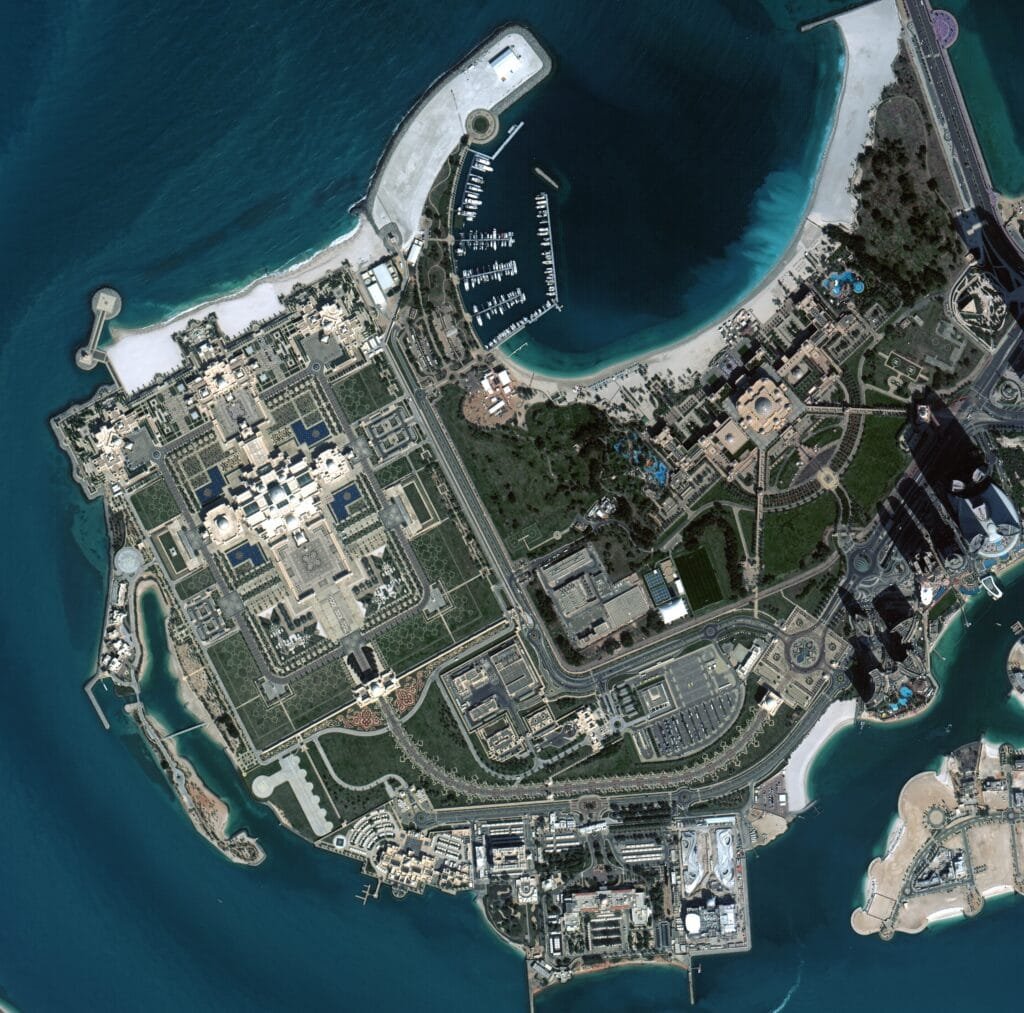
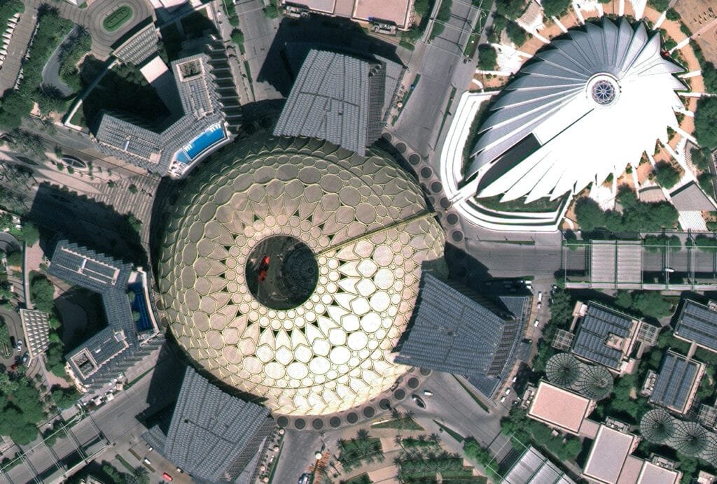
Dubai, United Arab Emirates – The Mohammed bin Rashid Space Centre (MBRSC) has revealed the first set of images captured by the Mohammed bin Zayed Sat and Etihad Sat satellites. These satellites were launched earlier this year. They coincided with World Space Week. This milestone represents a qualitative achievement that strengthens the UAE’s position in the field of satellite imagery. It also confirms its readiness to provide high-resolution data to support civil and marine applications, infrastructure, and sustainability efforts.
World Space Week was launched by a resolution of the United Nations General Assembly. It celebrates the contributions of space science and technology to the betterment of humanity.
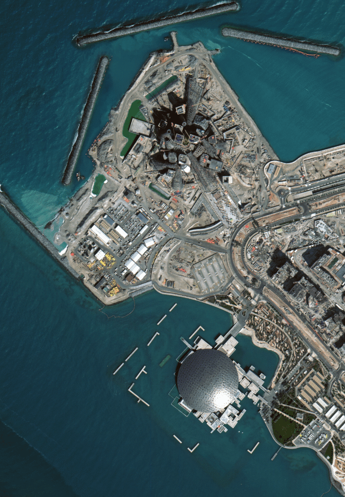
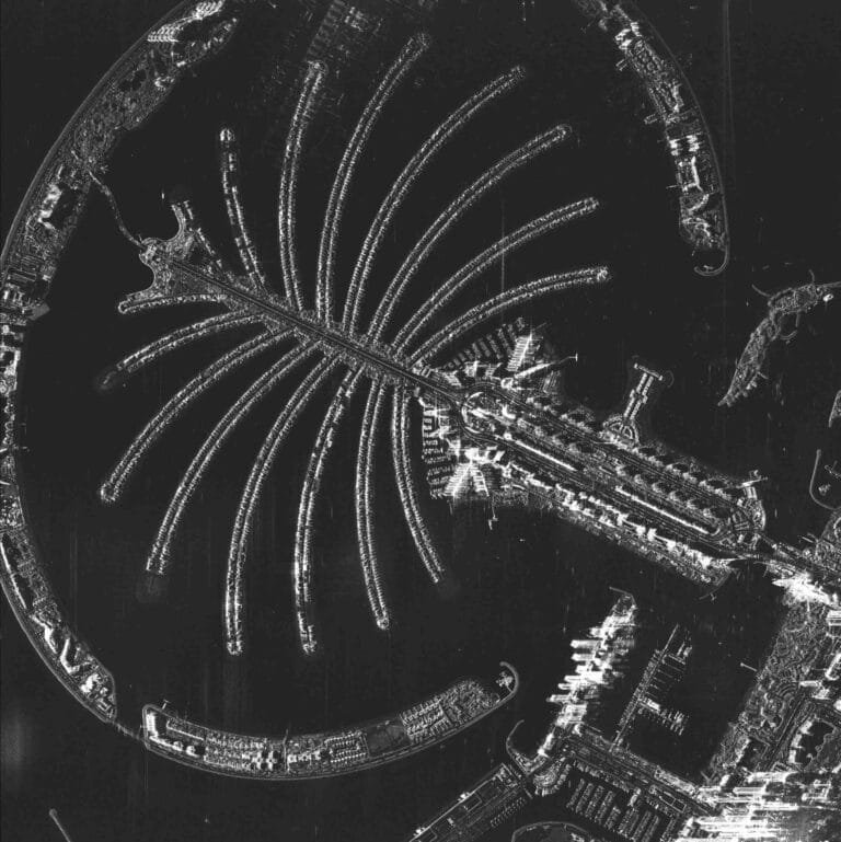
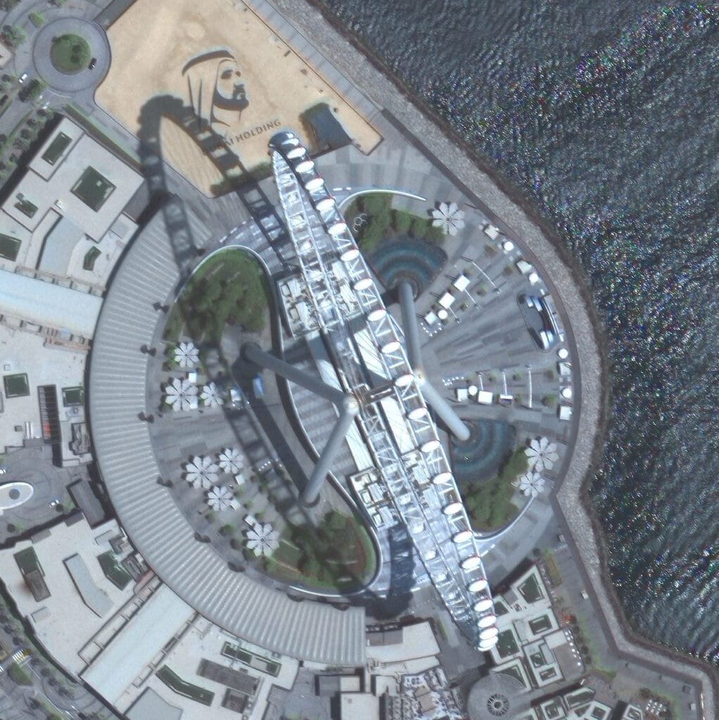
The two satellites embody integrated technologies. Mohammed bin ZayedSat relies on advanced optical imaging, while EtihadSat utilizes high-resolution radar (SAR) technologies. Together, they form an advanced system that provides a more comprehensive and accurate view of Earth observation.
His Excellency Hamad Obaid Al Mansoori, Chairman of the Mohammed bin Rashid Space Centre, said: “The first images sent back by the Mohammed bin ZayedSat and EtihadSat satellites reflect the strategic vision of our wise leadership. They embody the competence of our Emirati engineers. By integrating optical and radar imaging technologies, the UAE is enhancing its national capabilities. It provides innovative solutions to global challenges. This achievement represents a new chapter in the country’s journey towards leadership in space technology.”
His Excellency Salem Humaid Al Marri, Director General of the Mohammed bin Rashid Space Centre, said: “The Mohammed bin ZayedSat and EtihadSat satellites are part of an integrated national system. They develop the UAE’s Earth observation capabilities. The first set of images confirms our ability to provide accurate and reliable data. This data supports sustainability and serves various sectors. They also reflect our commitment to developing a new generation of satellites to serve the UAE and the world.”
MBZ-SAT: The most advanced satellite in the region
Weighing 750 kilograms and measuring 3m x 5m, MBZ-SAT is the result of extensive work by Emirati engineers from MBRSC. Local manufacturers also played a crucial part, with 90% of its mechanical structures manufactured in the UAE. It is equipped with one of the highest-resolution cameras in the region, capable of capturing images with double the precision of previous models. The satellite’s innovative systems include an advanced electric propulsion unit. Additionally, it has a star-tracking navigation system with meter-level accuracy. It also features data transmission rates four times faster than previous generations. Its onboard scheduling and processing allow images to be delivered within two hours of capture. This is a tenfold increase in efficiency. These capabilities make MBZ-SAT a powerful tool for monitoring environmental changes, managing infrastructure, and supporting disaster relief operations.
Beyond its technical advancements, the satellite’s development involved collaborations with local industries. These included Strata, EPI, Rockford Xellerix, Halcon, Falcon, and EGA. These collaborations reinforced national capabilities and transferred valuable knowledge to Emirati talent.
Etihad-SAT: MBRSC’s first SAR satellite
Etihad-SAT represents a major leap in the Satellite Development Programme. It is the first SAR satellite developed by the Centre. Unlike traditional optical satellites, SAR satellites use radar signals to capture high-resolution images. These images are captured regardless of atmospheric conditions, time of day, or cloud cover.
The satellite is equipped with three imaging modes: spot mode for detailed views of small areas, scan mode for wide-area coverage, and strip mode for extended regional monitoring. These capabilities allow Etihad-SAT to deliver indispensable data for maritime navigation, detecting oil spills, monitoring natural disasters, and supporting precision agriculture.
The data collected by Etihad-SAT is processed with advanced artificial intelligence systems. These systems enhance the accuracy, speed, and usability of the imagery for government agencies, research institutions, and private sector partners.
Its development also reflects MBRSC’s strategy of leveraging international collaboration. Emirati engineers worked closely with South Korea’s Satrec Initiative to finalize design and manufacturing. They ensured knowledge transfer to local teams.
Diverse satellite ecosystem
With the release of the first images from MBZ-SAT and Etihad-SAT, MBRSC underscores its commitment to creating a diversified fleet of satellites. These deliver unique but interconnected capabilities. The integration of optical and radar imaging represents the UAE’s ability to build a resilient system. This system can respond to urgent global challenges, from climate change to food security and urban development. The achievement also signals the UAE’s growing role as a global space technology leader. It offers advanced, reliable satellite imagery that benefits not only the nation but also the wider international community.