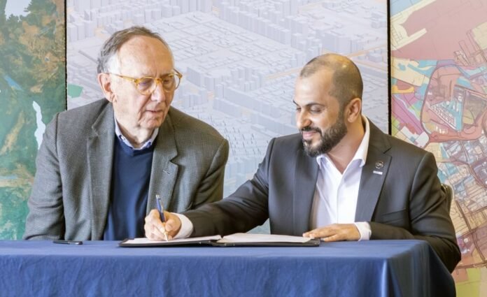
Abu Dhabi, United Arab Emirates – Space42 announced on Monday the signing of a memorandum of understanding with Microsoft and Esri to develop high-resolution digital maps covering the entire African continent. This initiative aims to support development and planning efforts in infrastructure, investment, and corporate decision-making across the continent.
This step comes within the framework of the “Map of Africa” initiative, which aims to create a unified and comprehensive map of the continent. It is the largest of its kind to date, encompassing 54 countries and more than 1.4 billion people.
The MoU aims to establish a smart information infrastructure that enhances the ability of governments, institutions, and communities to make accurate decisions and drive economic and social development based on data-driven knowledge.
The five-year partnership also aims to enhance geospatial capabilities in both Africa and the UAE, and provide accurate and accessible data to stakeholders at the national and regional levels.

Hassan Al Hosani, CEO of Bayanat Smart Solutions, a subsidiary of Space42, emphasized that building a more sustainable and resilient future begins with access to reliable data and accurate insights, especially in markets with information gaps. He explained that advanced geospatial maps and geospatial intelligence solutions are essential tools for supporting decision-makers, achieving comprehensive economic development, and empowering communities in Africa and other regions.
Peng Xiao, CEO of G42, said: “Artificial intelligence is a cornerstone of societal development, yet access to it remains limited in many countries in the Global South. This partnership represents a strategic step to bridge the data and knowledge gap and enable governments to make decisions based on insights and advanced analysis. Through this collaboration, we are working to transform artificial intelligence into a practical tool that contributes to smarter urban planning, the development of resilient infrastructure, enhanced natural resource management, and accelerated economic empowerment.”
Jack Dangermond, President of Esri, explained that transforming satellite imagery into accurate continent-wide maps requires advanced geospatial technologies and precise professional methodologies, the same capabilities that have supported similar initiatives in various regions of the world and are now being put to use in Africa. He said, “With this initiative, the partnership contributes to the creation of a vital resource that will support infrastructure planning and enhance economic and sustainable development across the continent.”

Integrated roadmap
Space42 is leading this pioneering project by securing funding, overseeing implementation, and providing satellite data through its sovereign capabilities and network of strategic partnerships. This data is analyzed using AI-powered digital twin models to produce dynamic maps tailored to different uses. The company is also leading an integrated research and development roadmap aimed at innovating new models and automating map production processes to meet future requirements.
Esri is leading the map development methodology, leveraging its advanced geospatial intelligence and remote sensing technologies, while supporting regional centers to train local talent and build sustainable capacity. In return, Microsoft provides secure cloud infrastructure via the Azure platform, enabling data processing, integration, and sharing at scale, ensuring operational efficiency and rapid access to actionable results.
As part of the G42 ecosystem, Space42 is further strengthening its collaboration with Microsoft to develop smart solutions that meet the needs of communities and support business ecosystems.
The initiative is expected to have a broad positive impact across multiple sectors, such as ports and logistics, renewable energy, security and disaster response, smart cities, and digital economies.
The data will be licensed to national government entities, ensuring their sovereignty over it and ensuring its continued updating by the relevant mapping authorities. The initiative also aims, in the long term, to enable an innovative commercial ecosystem that includes African startups that contribute to expanding the scope of geospatial solutions. The data will subsequently be stored in data centers operated by G42 and Microsoft on the continent.
The UAE is the largest foreign investor in Africa, with investments exceeding $44 billion by 2024, roughly equivalent to the combined investments of the United Kingdom and China. As the leading national space entity, Space 42 supports this agenda by exporting Emirati capabilities in artificial intelligence and geospatial data, enabling data-driven development.


